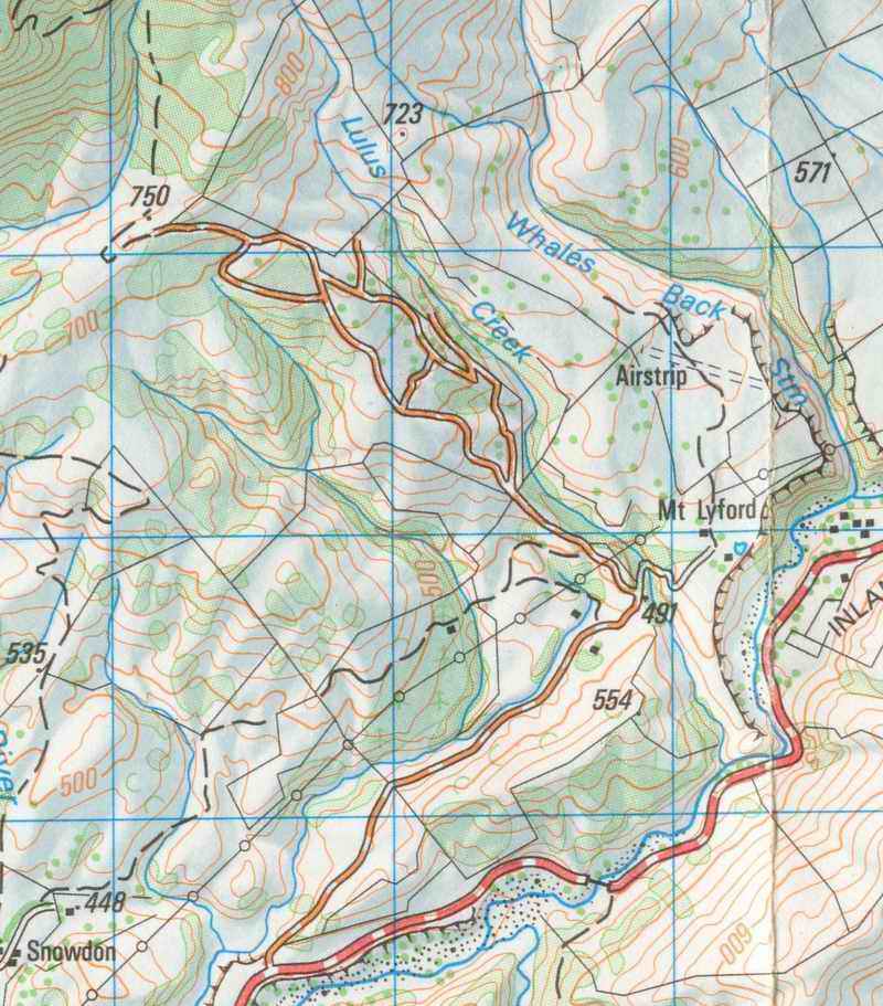
Many days can be spent ambling the Mt Lyford village environment. Four walks are described here. Some can be linked together to form a long day walk or they can be taken one walk at a time.
Tracks and signs are being developed, so at this time there tracks are
not always clear but the terrain is not dangerous and going from
landmark to land mark will mean you do not get lost, even if there is
the occasional tricky spot, or swampy patch.
Time: 2 hours
This walk starts near the Lodge and follows the ridge between the
Village Road and the Main Inland road. The track goes past
several private properties and then down again to Where the village
road takes a sharp left turn up the hill. From here you could go
back over the ridge or back along the road.

Time: Half a day
This is the spur that runs the length of the Village, one ridge to
the west. It takes you to the top of the village and from there
you can do the Totara Ridge and Chrystal Lake walks. Use the main map at
the top of the site for this walk.
From Mt Lyford Lodge cross the road towards the Horse Treks, cross the style near the sign and turn right to go down the track into the gully. Join the overgrown road that goes under the power lines and follow it, going through several gates, to its highest point, where there is a cattle track that takes you up onto the ridge. Keep following the ridge but it is not always straight forward. There are fences to climb over and places where it is hard to avoid some serious bush crashing.
The route comes out in the four wheel drive area at the top end of the village.

Looking up to the start of the walk from the Mt. Lyford Lodge:
Time: Three Hours
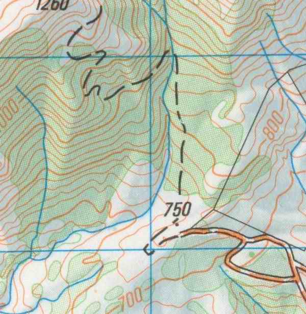

This ridge goes from the other side of the Wandle up through the grassy slope and then through regenerating Totara to meet the road just above where it crosses the Wandle River. This route combines well with the "Mountain Bike Track" route on the Chrystal Lake walk to form a round trip from the Wandle basin, through bush avoiding the Ski Road.
From the Wandle basin cross the river near the "gravel grill" and head on up near the cairn. We have marked the route with small plastic strips tied to bushes. The going is pleasant enough, but there is no definite track.
Just before coming out on the Ski Field road the track takes a sharp turn right so as to go to the best place to negotiate the bank up to the road.

Time: Three Hours
Map: Use the same map as for the Totara Ridge Walk
Chrystal Lake nestles in the bush on the village side of the Ski Road. It can be approached from several directions: The Lake Chrystal Saddle, The Mountain Bike Track or from the Ski Road.
The Chrystal Lake Saddle is the low point on the ridge that runs from the road up to the top of Mt Lyford. You can go up this ridge from the play ground area by the main gate to the Ski Road. There are various ways of getting to the top of the ridge, once there follow it to the saddle. From there follow a well used animal track that heads down to lake Chrystal. (If you are fit enough and have gear for higher country you can go on to climb up to Mt Lyford along the ridge. This could take most of the day)

Here is a view of Mt. Lyford looking up at the Chrystal Saddle from
the Wandle basin.
Another good way to Chrystal Lake is to use the Mountain Bike Track from the Wandle Basin. This track was cut in 1999 it starts above the basin at the end of the four wheel drive trails. It heads up steeply through bush and grass and then heads left into the bush and comes out at the lake.
It continues past the lake through bush all the way to meet the Ski Field road not far from where the road crosses the Wandle river.
There is only a short stretch of road between the Totara Ridge walk and where this track comes out, making it easy to combine the two walks.
Note: Mentioning these walks here does not imply permission to walk on the private property near or around these walks. Permission from the owners for these walks has been established for the main routes described however part of the purpose of this guide is to work towards firming up the permissions, plans for signs, routes and tracks.
The names of various features are simply what we have come to know these places by and we would be happy to stand corrected if there are other names that are more formally correct or in local usage.
Comments, suggestions and ideas for more walks to walter@psybernet.co.nz
Last updated: Tuesday, 12 August 2003